Survey & Inspection (DSI)
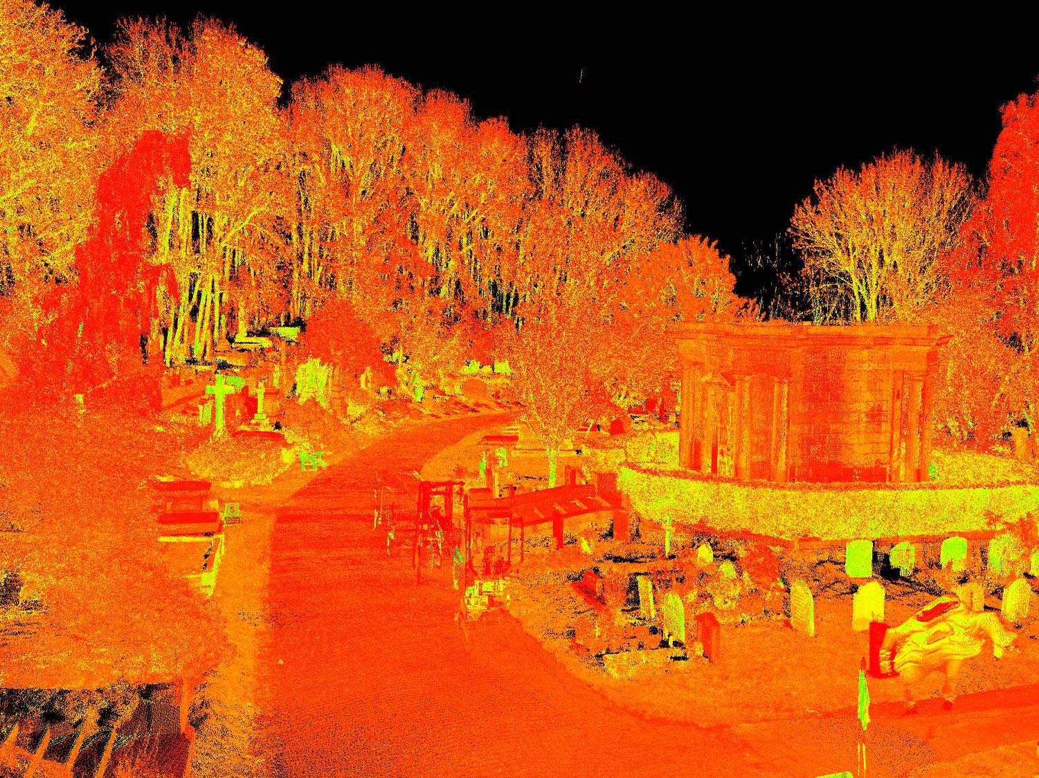
TEXO was commissioned to produce a detailed 3D Point Cloud and LiDAR Survey of Highgate Cemetery located in North London. The Cemetery is designated Grade I on the Register of Historic Parks and Gardens and is one of the Magnificent Seven cemeteries in London. There are approximately 170,000 people buried in around 53,000 graves across the West and East Cemeteries.
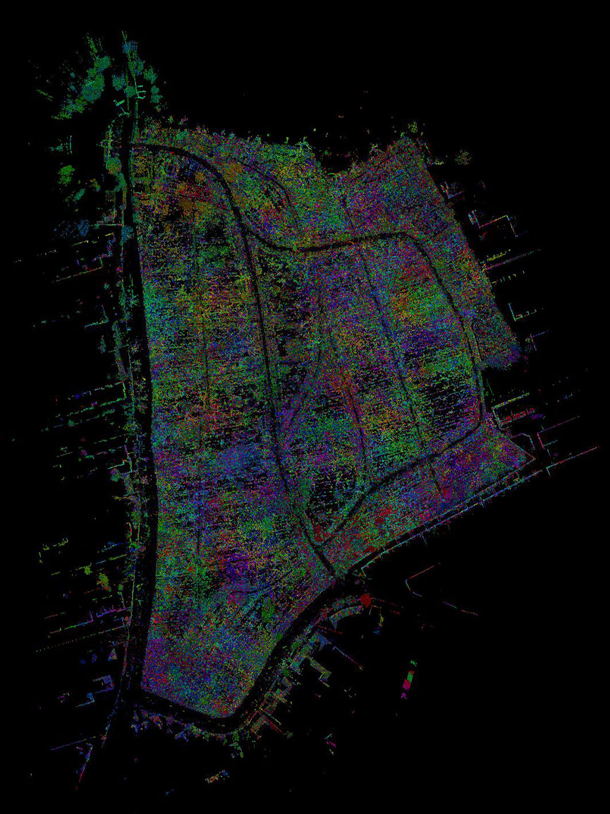
The scope was to accurately capture topographical detail across the site with three key goals: ground surface representation, feature coverage and minimising time on site. With the site conditions, scope area and the three survey goals in mind, the operations were conducted using a combination of techniques involving both UAV and terrestrial operations.
Solution
With challenges facing the team of densely vegetated areas, conflicting site activities and accessibility around full cemeteries, TEXO needed to be able to provide a ‘right first-time’ survey solution from which a 3D topographical survey could be delivered. Using UAV LiDAR and High-Res Terrestrial Scanning ensured data was suitable.
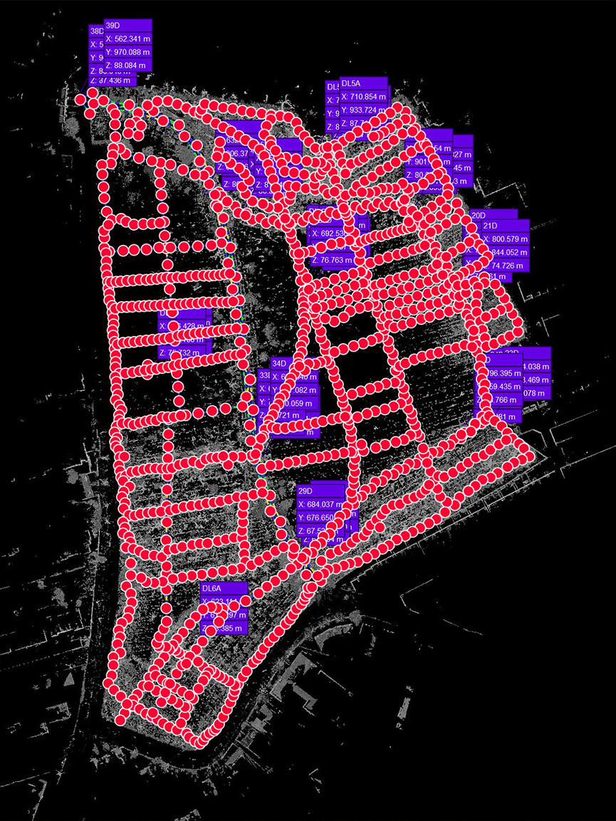
Survey Control: A traverse was conducted for each cemetery with a dense network of scan targets positioned, observed and verified across all survey areas ensuring scan tolerance can be report verified.
3D Laser Scanning: Laser scans were observed using Leica RTC solution, offering unrivalled capture and quality balance, and a mixture of density settings and positioning to ensure scan overlap and feature coverage paired with UAV LiDAR infill.
UAV LiDAR: By deploying our UAV LiDAR system, we guaranteed accurate ground surface levels through even the densest vegetation. This enabled a detailed ground surface model, and contour plot to be developed. It also reduced the time on-site and potential safety issues by capturing data in ‘live’ construction areas.
Result
TEXO captured and delivered to the client:
• 3D LiDAR Point Cloud – ReCAPfiles
• Ground Laser Scan Point Cloud – LGS files
• Control Report
All data was hosted for the client on Texzone, providing the client’s team with an interactive single point of record for all survey outputs, easily downloaded and shared. TEXO are proud to achieve the survey goals of zero safety incidents, minimal disruption to ongoing site activities/road networks and level coverage across the entire site.