Workspace Solutions
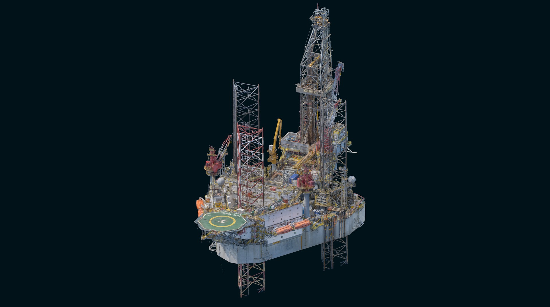
As built 3D Reality Capture of a Jack Up Rig in the North Sea Offshore Industry utilising a combination of high accuracy dimensional control establishment, Laser scanning technology and UAS mounted payloads for photogrammetric capture
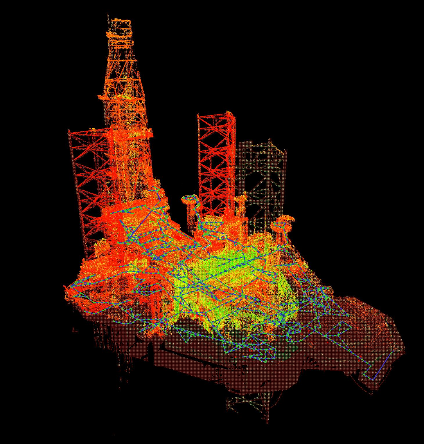
TEXO were commissioned to provide a 3D point cloud model of this operational jack up rig situated in the North Sea Sector.
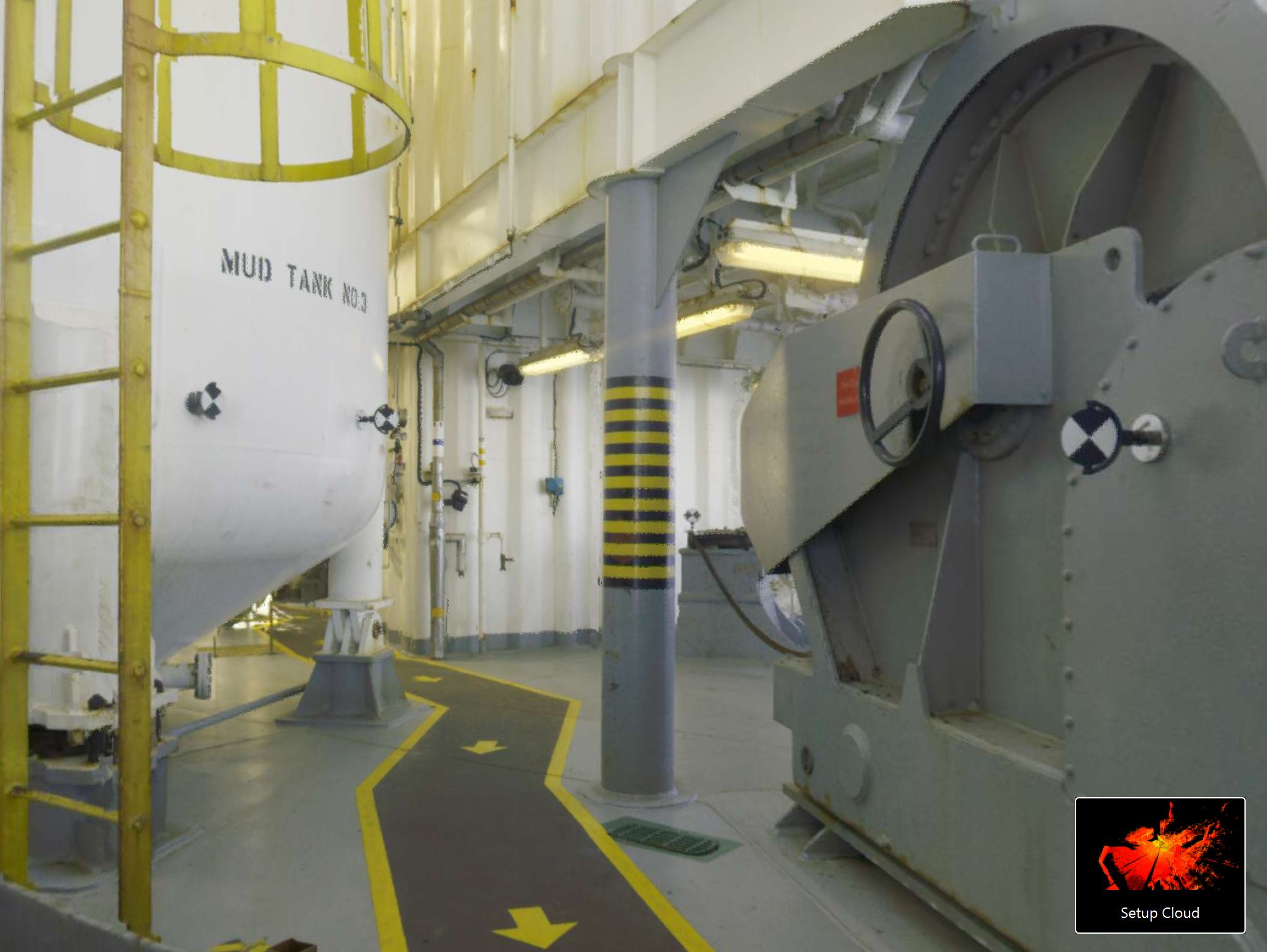
The scope was to capture the entire platform to a tolerance of +/-5mm. For anything ‘topside’ and accessible on the platform, this is a straightforward exercise using traditional scanning and Dim con methodology, but for the underdecks or spiderdeck, gantries and walkways, which are much harder to access safely. So the company needed a safe, reliable way to capture the underside of the rig. TEXO’s extensive offshore experience using the latest in survey technology was paramount to the safe, efficient and accurate capture of this platform.
SOLUTION
Dimensional Survey Control
Using a 1” total station instrument a dense network of scan targets were positioned, observed and verified across all survey areas ensuring scan tolerance can be report verified. Resection methodology was employed across the platform to ensure the geometry of the targets was sufficient to verify the overall 3D point cloud accuracy to the end client.
Laser Scanning
Full RGB Static laser Scans observed using Leica RTC solution, offering unrivalled capture and quality balance. Mixture of Density settings and positioning to ensure scan overlap and feature coverage paired with UAV photogrammetric infill.
UAV Photogrammetry
Systematic capture of external areas with high resolution payload for photogrammetric infill. 10,000 images were incorporated into the 3D laser scans to ensure every inch of the platform was captured.
Result
TEXO captured and delivered the client with over 650 full colour scans registered into sub 5mm accurate 3D point clouds. Delivered in conjunction with over 10,0000 UAV images of the platform areas. All data hosted for the client on Texzone, providing the clients team both on and offshore with an invaluable collaboration and data management system and a single point of truth for their asset organized for seamless accessibility.