News
How a combined survey approach can reduce time and improve data quality
A good quality survey, dimensional or inspection based is essential to any project. From improving sea defences to building new homes, no project can progress confidently without reliable survey information on which to base decisions.
That’s why a combined approach to project surveys is so valuable. By using both ground-based and air-based survey and inspection methodologies, we can offer more complete, more interactive and more useful datasets, giving project managers clearer insight into the nature of their site and supporting more informed decision making.
Ground-based surveys
These traditional surveys, carried out with equipment such as Total Stations & Terrestrial Scanners allow surveyors to observe and record accurate locations of objects and features such as drainage covers, buildings and ditches. Ground-based surveyors will also aid UAV teams in marking Ground Control Points – markers that are used to tie in both ground and aerial data to the same control network, a critical part of providing seamless integration between datasets for clients.
The importance of having a ground-based survey team can never be overlooked, it provides valuable insight into features that may otherwise be obscured from UAV data collection. Our surveyors feed this information to our UAV team who can tailor flight paths to collect what otherwise might be missed.
Air-based surveys
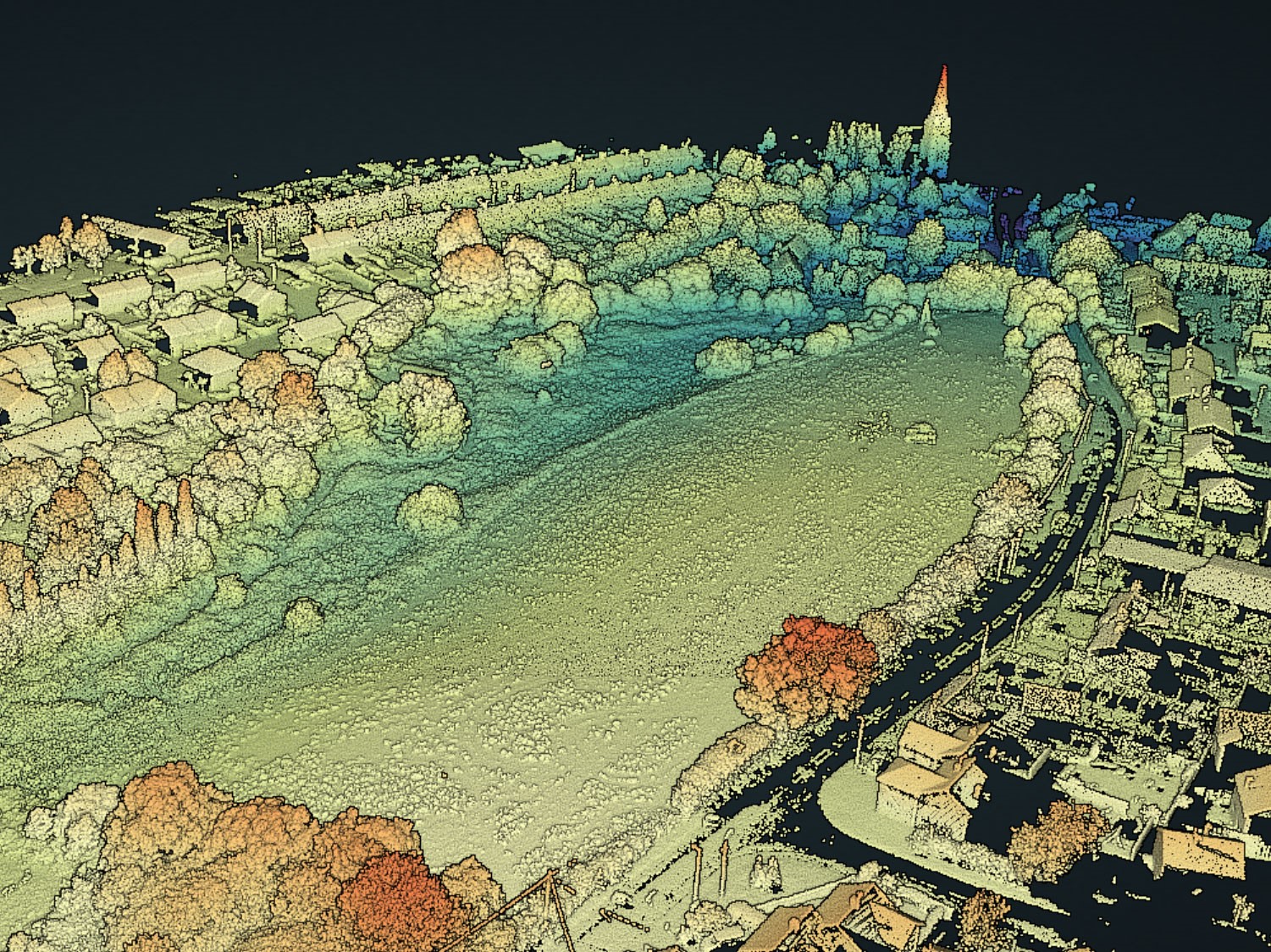
Usually undertaken using unmanned air vehicles (UAVs), commonly known as drones, air-based surveys gather data from a different perspective and can survey areas where it might be difficult, dangerous, and even impossible for a ground-based survey team to access, a problem often encountered in this industry. This includes particularly dense vegetation, quarries or steep cliffs and even underground features like old tunnels. TEXO are able to mount LiDAR sensors and various camera payloads on UAV platforms which enables collection of accurate 3D point cloud data / photogrammetric data which can then be integrated with traditional ground-based observations to provide a more comprehensive survey.
The benefits of a combined survey approach
Of course, both of these survey approaches can be used independently and will provide the level of data that most projects initially require. It’s often the case, however, further surveys may be needed because certain features or details weren’t captured on an initial visit as these were not required in the original specification. Using a combined approach can potentially eliminate the need for additional surveys, increases efficiency and quality and most importantly gives project teams more data that they can interrogate and interpret to help their project.
- Efficient Data Collection – Ground and air surveys can be conducted at the same time. This allows clients to get data faster, without any delays. Having teams that are multi-disciplinary is key to this offering.
- Data Quality – By using both approaches, you improve the quantity and quality of the data collected, so that your project has more information to work with.
- Survey Completeness – One solution is not the answer on most projects. A multi-disciplinary approach means you get better coverage across the site. We always promote leaving no stone unturned in terms of data capture.
A joint approach in action
TEXO were asked to carry out a survey for a large housing development in the Essex area. The overgrown site had dense vegetation throughout, and the client wanted a survey to determine a drainage strategy.
We used traditional survey practices to establish ground control and capture topographic detail in accessible areas, however promoted the use of UAV LiDAR and photogrammetry to capture detail in the otherwise inaccessible areas, enabling production of a topographical drawing that has 100% completeness.
Our client viewed the data using our Texzone software, which gave them access to all the data collected. This allowed them to see the full site in detail, take relevant measurements and share the data within the team to help with internal planning and project design.
To find out more about how a combined approach can give you faster, more precise and easily-accessible survey results, contact our team today: info@texo.co.uk