Survey & Inspection (DSI)
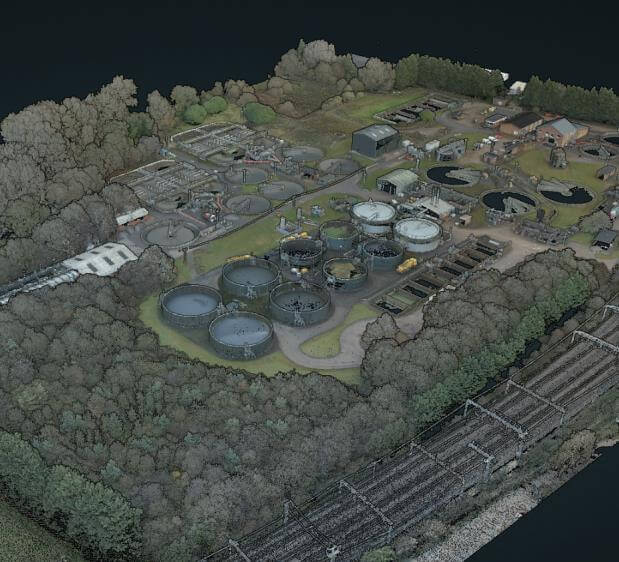
TEXO were commissioned to document and capture this site as part of an ongoing framework. The project required design grade accuracy 3D capture of the site via traditional topographic and utility collection, but the site features also prompted the use aerial UAS based LiDAR & Photogrammetry to aid detail collection and identification.
The client required detailed inverts, piping layouts and critical levels across site to ensure that future design.
The Solution
Survey Services delivered;
- High Accuracy Primary Survey Control
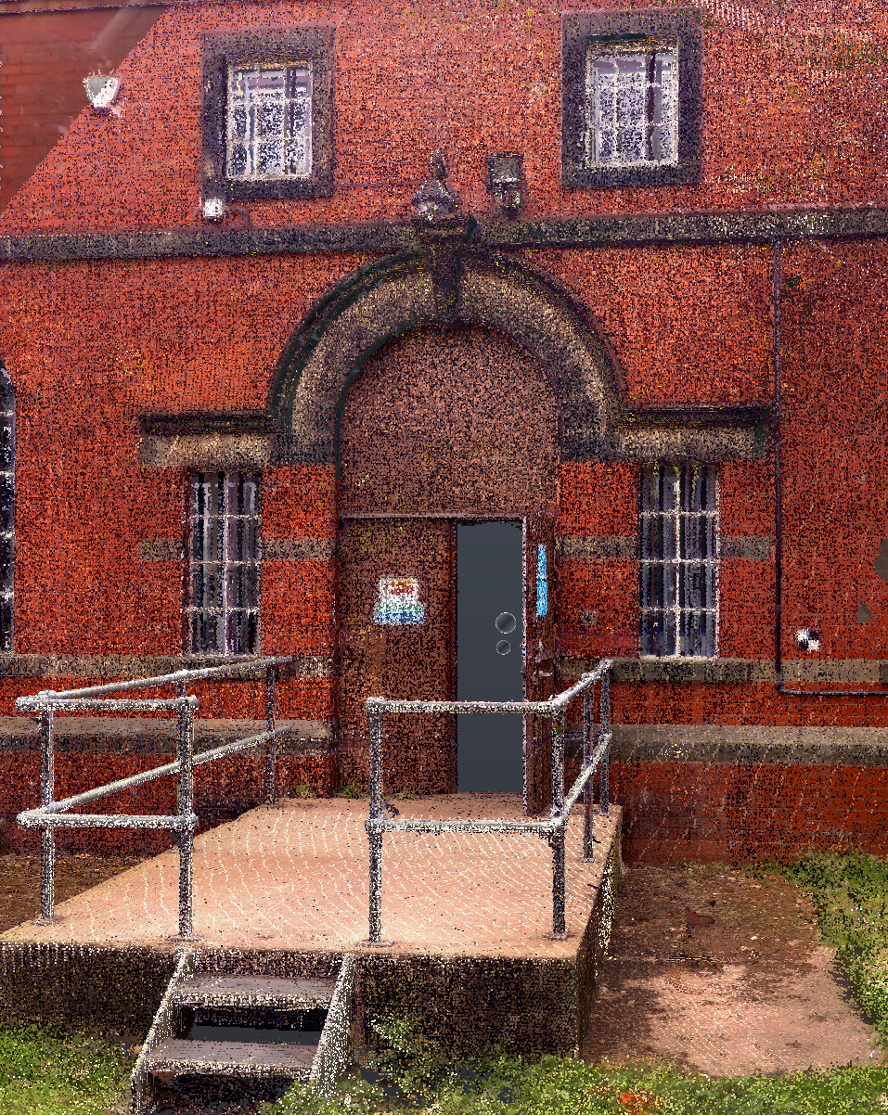
- 3D Terrestrial Laser Scanning
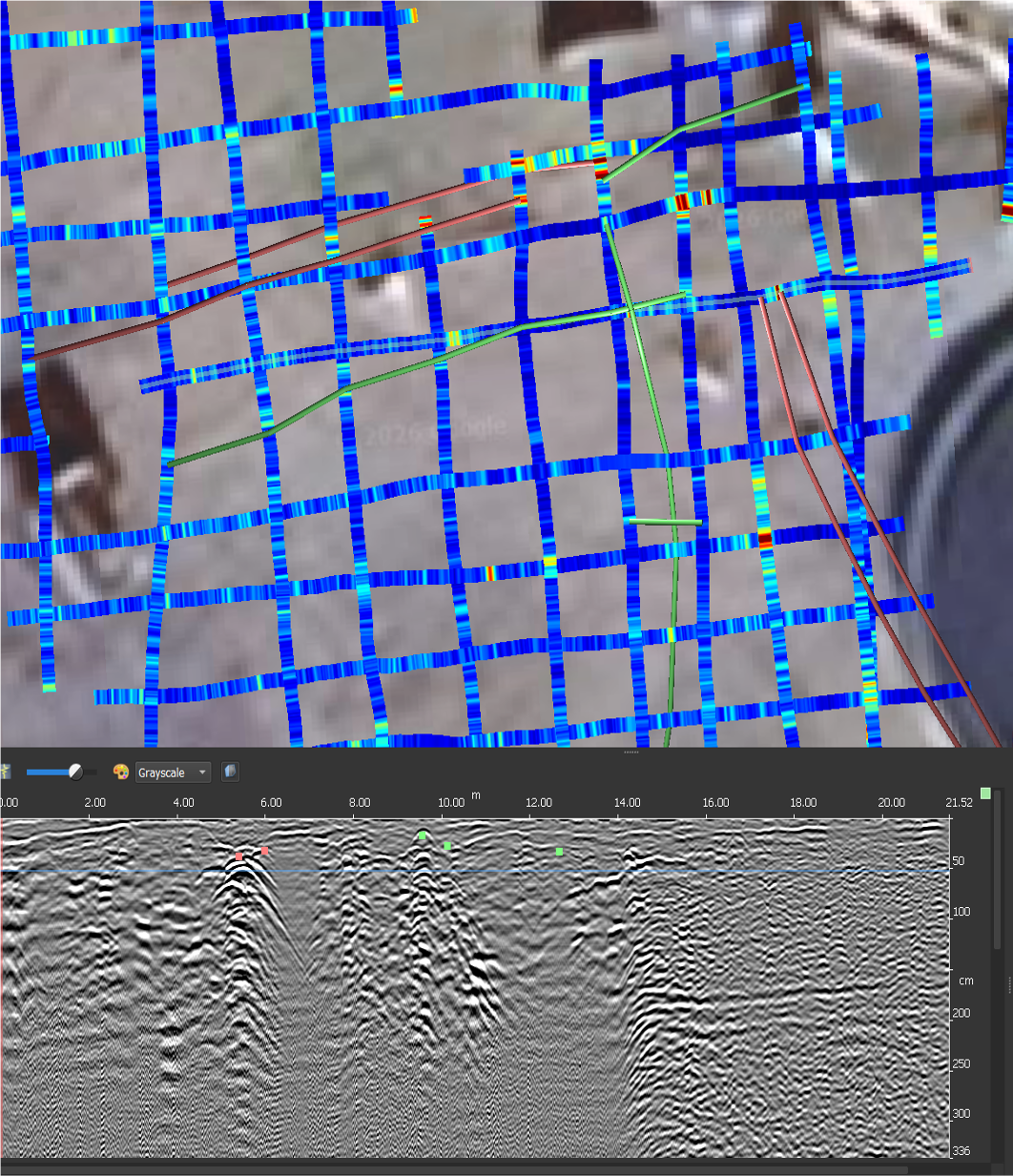
- UAS Photogrammetry
- UAS LIDAR
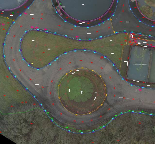
- Underground Utility Survey
The Result
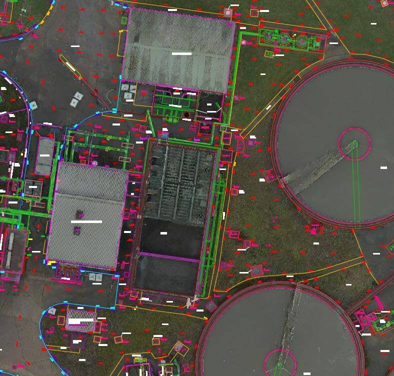
- Hybrid 3D Point Clouds
- Orthomosaic of – DEM & DSM (ECW & .Tiff format)
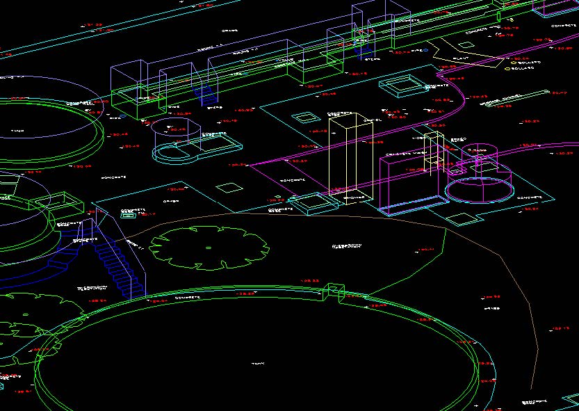
- 3D Topographic Survey (.dwg format)
- 3D Utility Survey (.dwg format)
All data hosted for the client on Texzone, providing the clients team with an interactive single point of record for all survey outputs, easily downloaded and shared. TEXO were proud to achieve the survey specification with zero safety incidents, minimal disruption to ongoing business operations.