Survey & Inspection (DSI)
Survey & Inspection (DSI) > <
Highfield Lane – Route Proving for Proposed Rising Main
The Challenge
The project required a high-accuracy topographic and PAS128-compliant utility survey to support ground investigation and pipeline route proving across an extensive operational corridor exceeding 6km. The primary difficulty lay in the scale of the site and the requirement to integrate data from several operational pumping stations. Traditional survey methods alone would have been prohibitively slow for a 6km route, yet the accuracy requirements for the pump house environments demanded sub-5mm precision for complex mechanical and structural interfaces.
The Solution
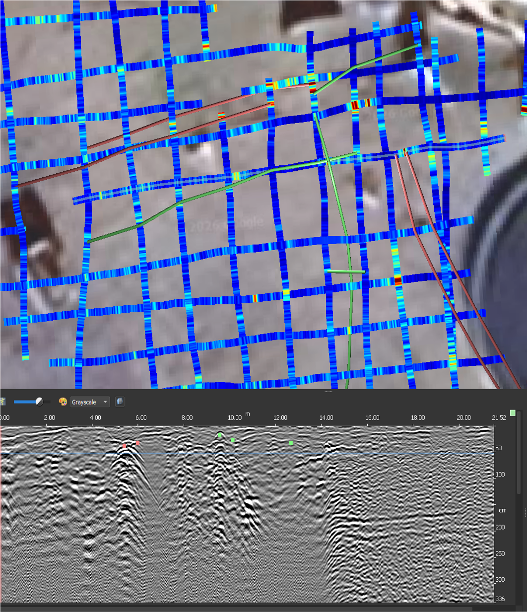
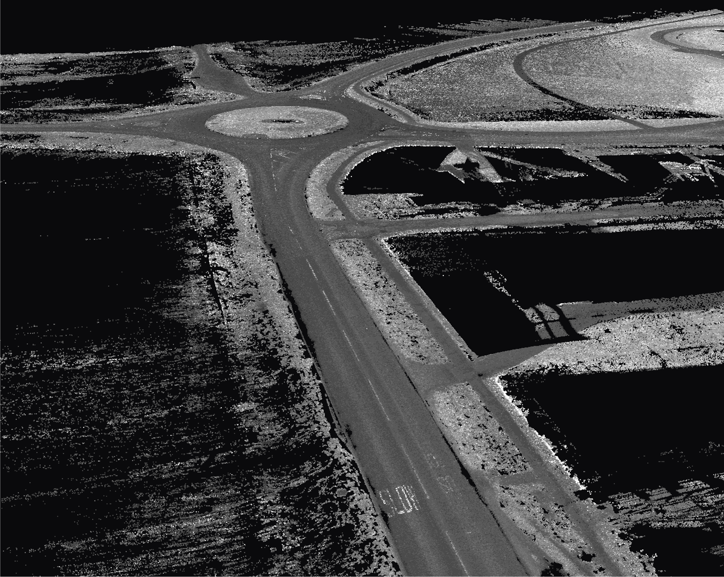
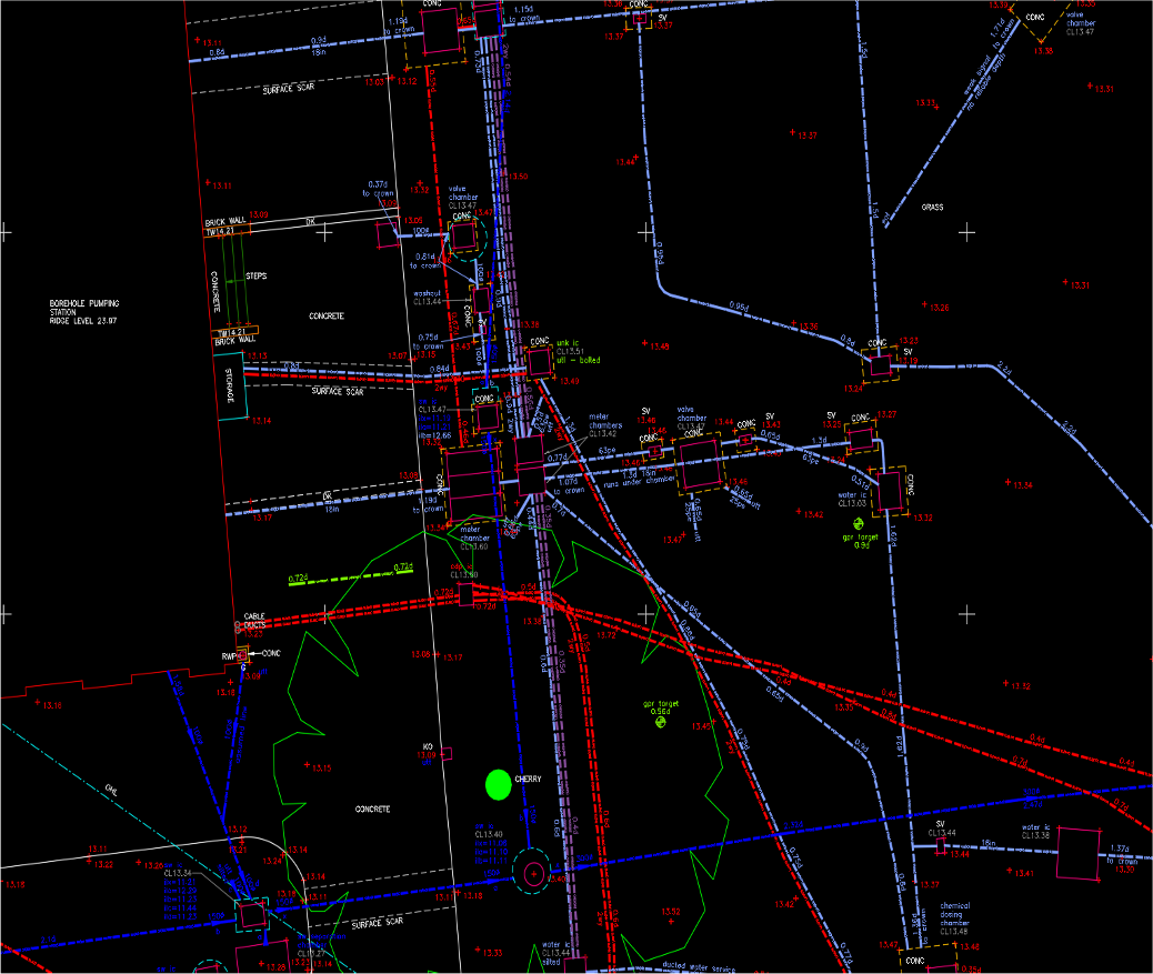
TEXO deployed an integrated “hybrid” survey methodology to balance speed with highorder accuracy. For the 4.5km rural A-road section, a vehicle-mounted RIEGL VUX-1 Mobile Mapping LiDAR system was used to capture high-resolution spatial data without the need for traffic management or lane closures. For the high-complexity pumping stations, Terrestrial Laser Scanning (TLS) using the Leica P40 was employed to capture millimetre-level detail of structural elements and pipework. The survey was georeferenced using a Leica TS16 Total Station and GNSS to ensure a unified coordinate framework. Concurrently, a PAS128 Utility Survey was conducted using electromagnetic locating and multi-array Ground Penetrating Radar (GPR) to map subsurface assets.
The Result
The hybrid approach delivered a comprehensive digital twin of the route with varying levels of detail optimized for the environment: sub-5mm accuracy in critical pump house areas and sub-10mm accuracy across the mobile LiDAR route.
Data was processed through N4CE, Leica Cyclone, and Autodesk ReCap to produce high-density 3D point clouds (LAS/RCP) and 2D CAD drawings (DWG). This provided the principal contractor and the water utility provider with design-grade data for route selection while significantly reducing the time-on-site and safety risks associated with traditional highway surveying.