Survey & Inspection (DSI)
The Challenge
In preparation for site development works at an operational water recycling centre, the principal engineering contractor required a definitive map of all underground utilities. The challenge was inherent to the age and complexity of the operational water treatment facility; existing asset records were incomplete or unreliable, and the high density of buried services made geophysical interpretation difficult. To support engineering design and risk reduction, the client required more than just “detected” lines—they needed verified data on depths, pipe materials, and flow directions.
The Solution
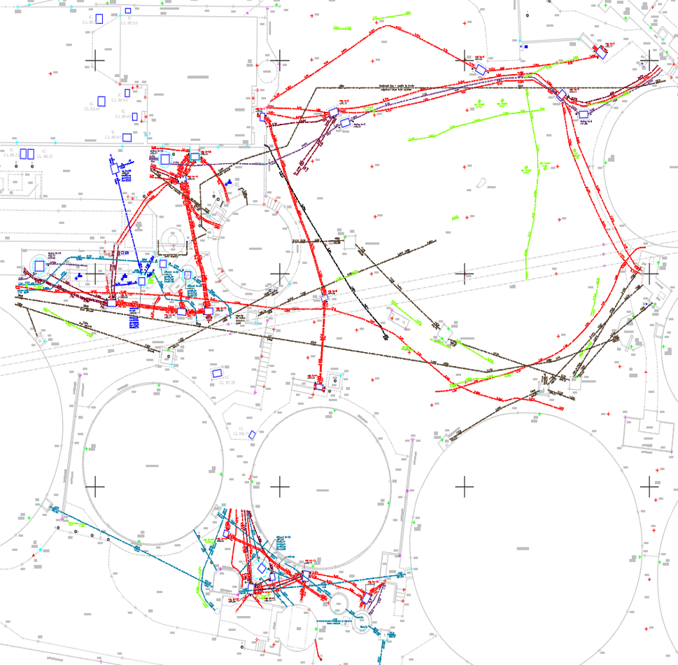
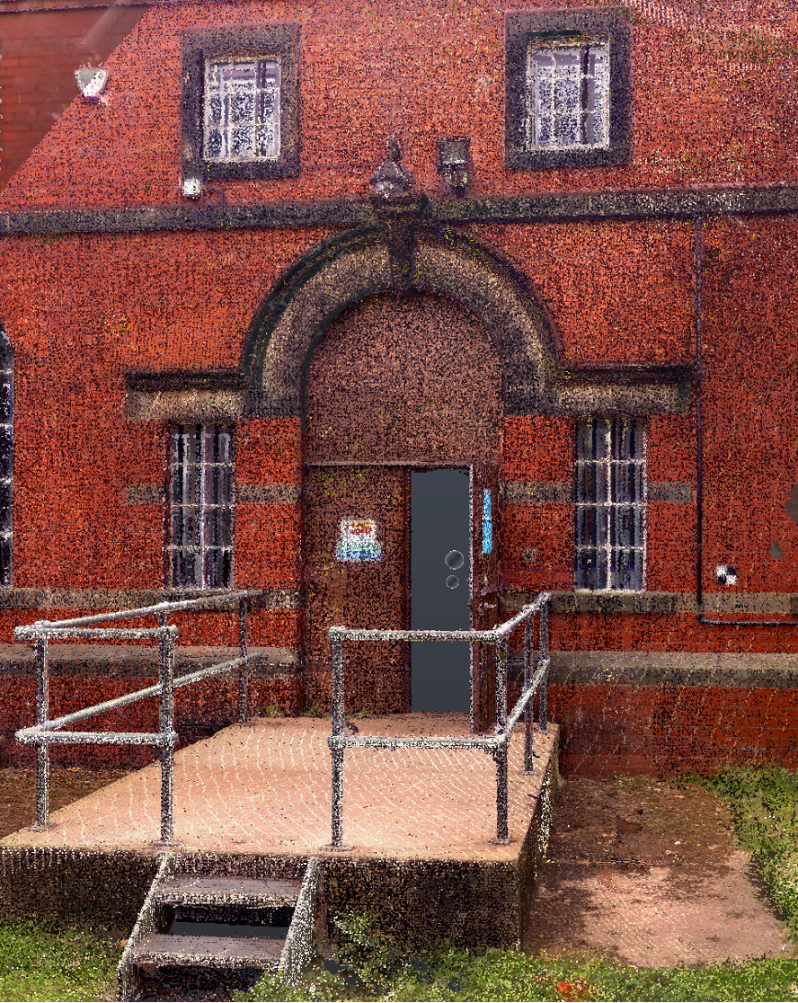
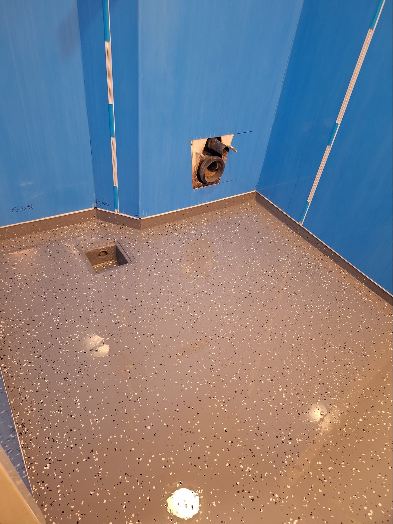
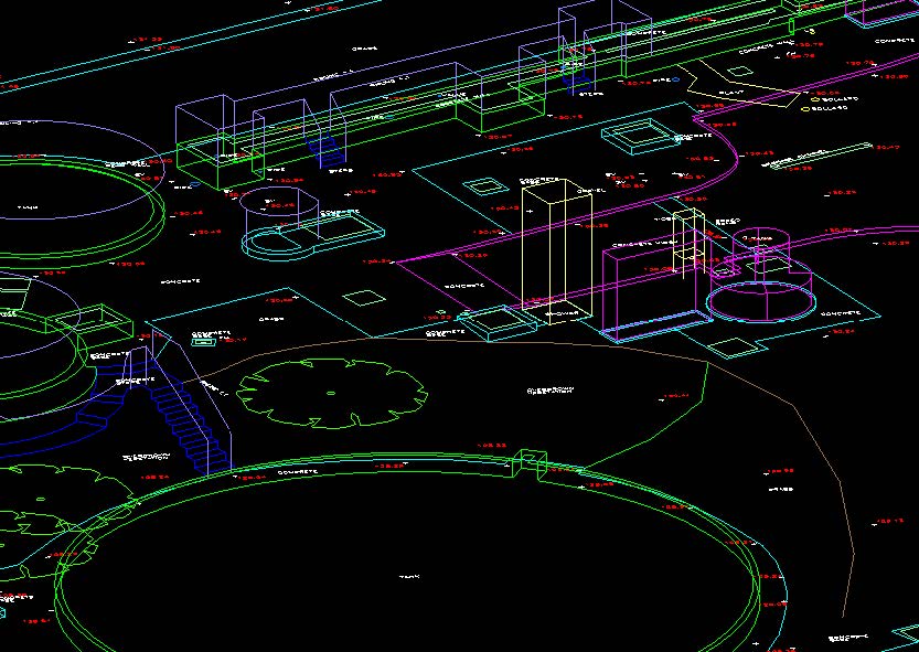
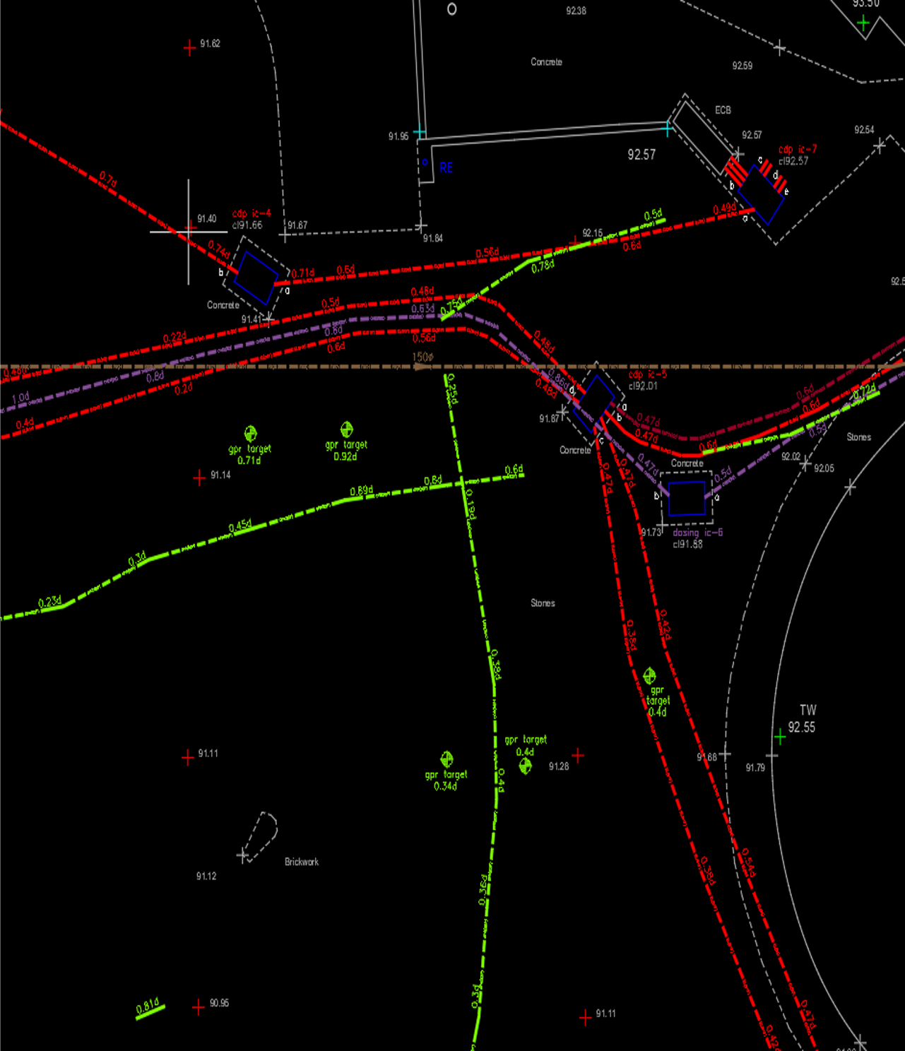
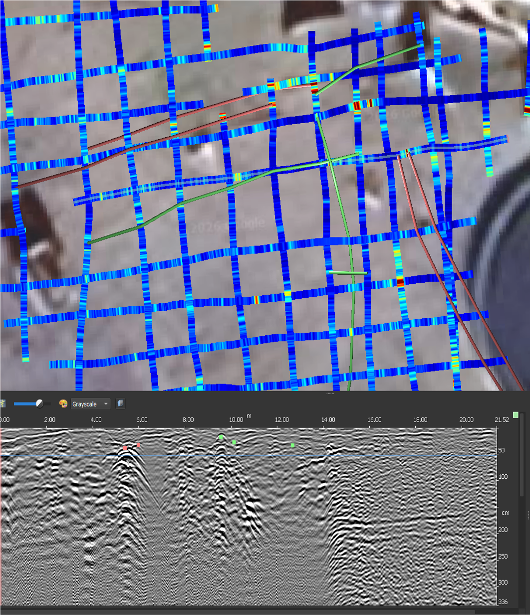
The survey followed a rigorous PAS128-compliant methodology, utilizing electromagnetic locating and GPR. However, the core of the solution was a comprehensive Inspection Chamber (IC) Reporting campaign. Surveyors accessed every reachable chamber to perform visual inspections and physical measurements. Each report included invert levels, pipe diameters, material types, and flow directionality, all georeferenced to the site coordinate system. This physical verification was cross-referenced with the geophysical data to resolve “blind” areas where surface methods alone were insufficient.
The Result
By integrating geophysical detection with physical IC reporting, TEXO provided a highly reliable representation of the buried network. The final deliverables included 2D PAS128 Utility Survey drawings and a detailed photographic appendix of all inspection chambers. This granular level of detail allowed the project team to progress development planning with significantly reduced uncertainty, avoiding the high costs associated with utility strikes or design changes necessitated by unmapped infrastructure.