Survey & Inspection (DSI)
The Challenge
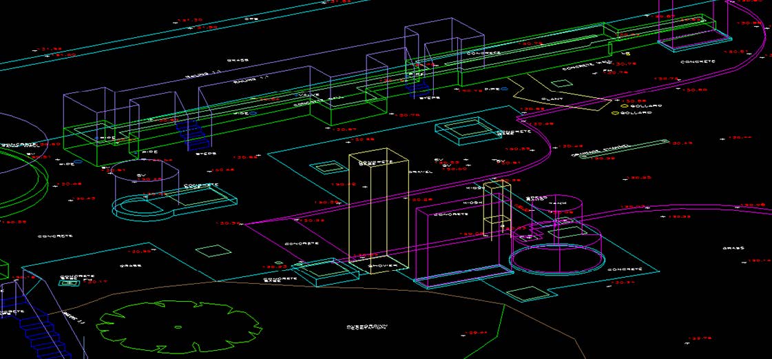
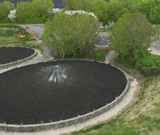
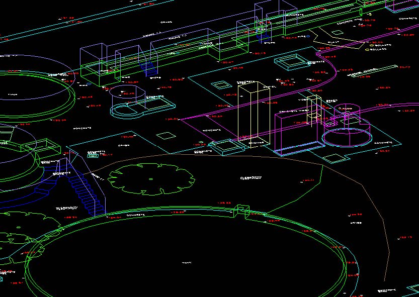
As part of the AMP8 infrastructure upgrade initiative, the regional water utility provider required a comprehensive survey of an operational sewage treatment facility. The site presented a mix of dense mechanical infrastructure, operational tanks, and areas of heavy vegetation and uneven terrain. The design team required a “design-grade” dataset that unified surface topography, highdensity 3D structural data, and subsurface utility information into a single, coordinated model to support detailed engineering optioneering.
The Solution
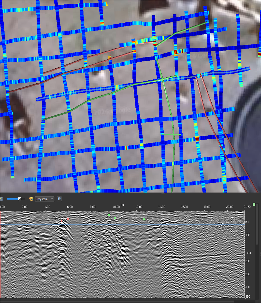
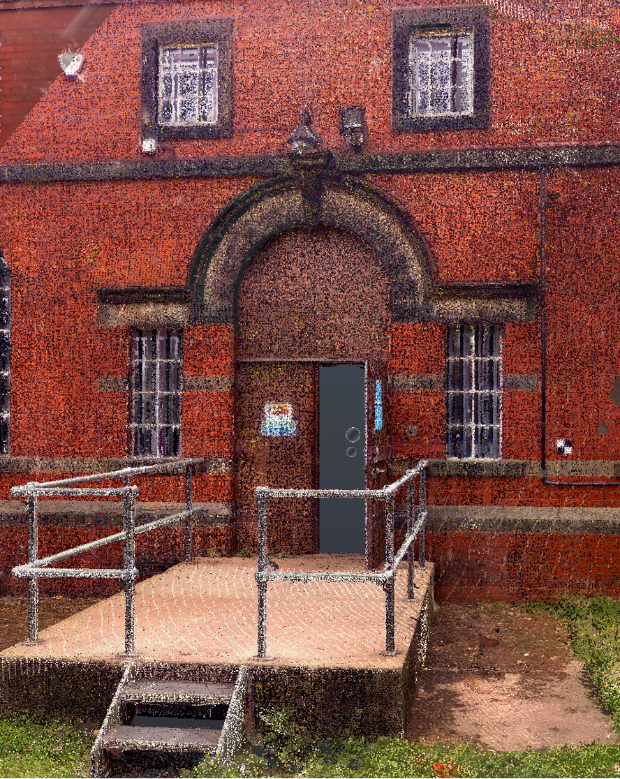
TEXO utilized a multi-platform data capture strategy over a 5-day site period. UAV LiDAR and Photogrammetry were used to rapidly capture the wider terrain, vegetation-covered areas, and rooflevel assets. Simultaneously, Terrestrial Laser Scanning (Trimble X9) was deployed to capture high-density 3D point clouds of the filter beds, tanks, and intricate mechanical pipework. To complete the dataset, a PAS128-compliant utility survey used GPR and electromagnetic techniques to trace buried services. All data streams were processed and fused over 10 days into a single, georeferenced environment.
The Result
The project delivered a holistic view of the facility, combining 2D topographic drawings, 3D models, and high-density point clouds with orthomosaic imagery. The use of UAV technology provided a perspective on asset condition and terrain that traditional land surveying could not achieve in the same timeframe. The resulting dataset provided the client’s design team with a “single source of truth,” enabling accurate spatial analysis, asset management, and risk mitigation for the upcoming AMP8 infrastructure upgrades.