HVAC & Refrigeration
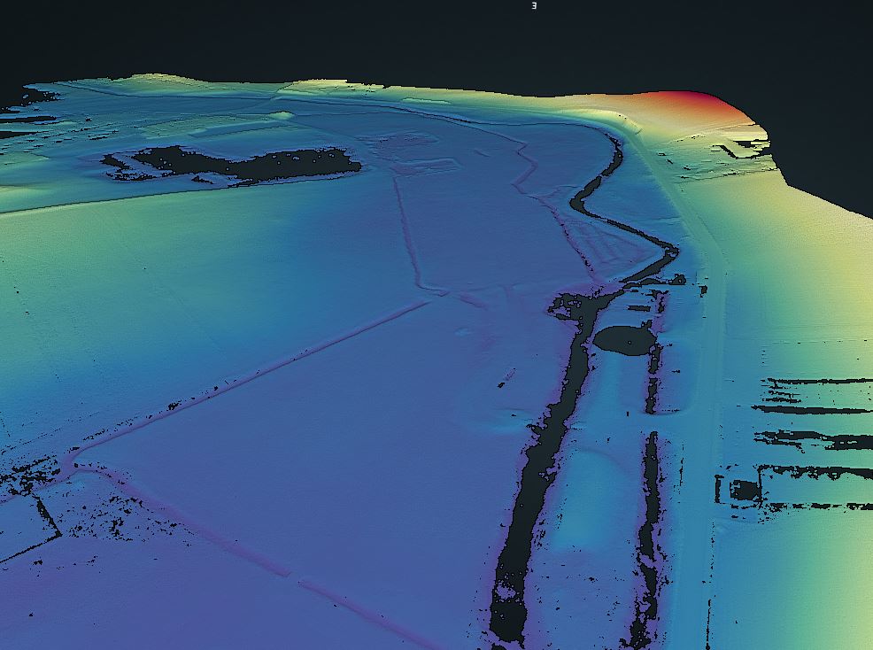
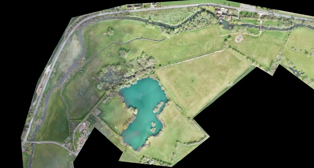
UAS LiDAR and photogrammetry survey of 100Ha site
Our client needed support on this site to capture topographic information over varied site conditions, including woodlands, scrub, meadows, lakes, and watercourses.
They also required the extraction of data to produce a digital terrain model and 3D topographic information for the design team.
SOLUTION
- UAS LiDAR and photogrammetry survey of 100Ha
- Bathymetric survey of water courses and rivers
- ROV sonar survey of lake
- Extraction of DTM and topographic detail from Point Cloud.
RESULTS
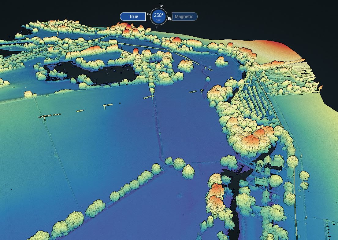
High-quality DTM information from UAS LiDAR in overgrown and woodland areas, giving extensive level coverage across the whole site.
UAS capture of topographic information to minimise ground-based survey in sensitive areas.
Bathymetric data integrated into final data set.
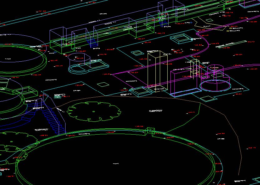
Production of 3D topographic information including:
- 3D LiDAR Point Cloud in .las format
- Classified Ground Point Cloud
- Site Orthomosaic in Geotiff format
Digital Surface Models and topographic detail in 3D AutoCAD format